Features
Built for one job:
running a trap line.
Every tool below is in the app today, on your phone and your computer. Most are free; the ones marked Pro or Crew come with a paid plan.
- 01
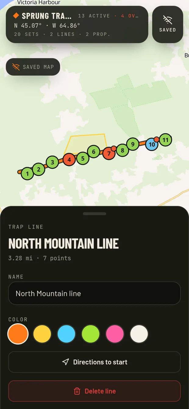
Offline mapsPro
Save map areas to your phone and keep working with no cell service.
- Save the areas you trap
- Drop sets and log catches with no signal
- Everything syncs once you're back in service
- 02
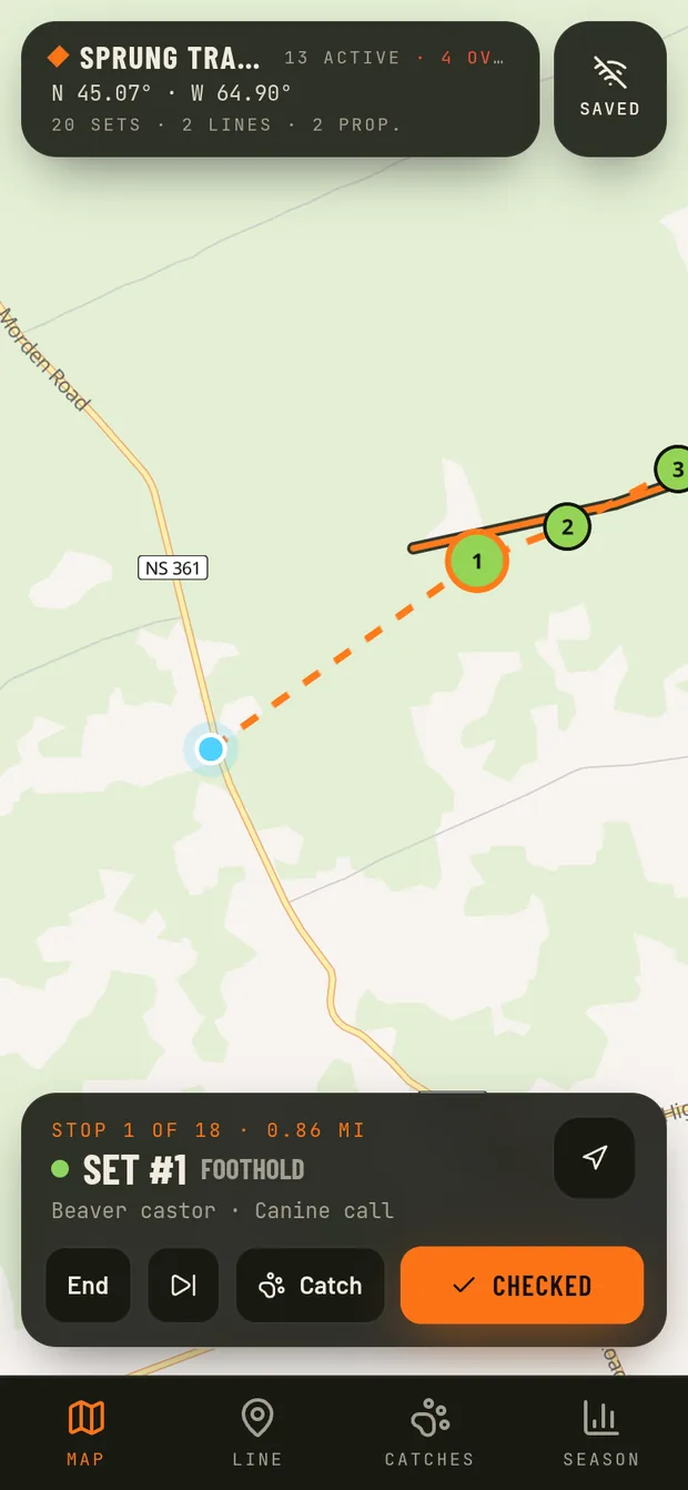
Run the line
Get the closest unchecked set first, then step through the rest one by one.
- Check order from where you're standing
- Skip a set and come back to it
- Mark each set as you go
- 03
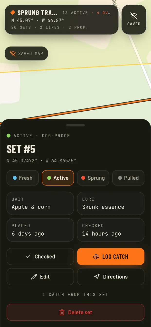
Drop sets
Pin every set where it sits. Mark it fresh, active, sprung or pulled with a tap.
- Set number, type and notes on every pin
- Status colors you can read at a glance
- Sets not checked in 24 hours get flagged
- 04
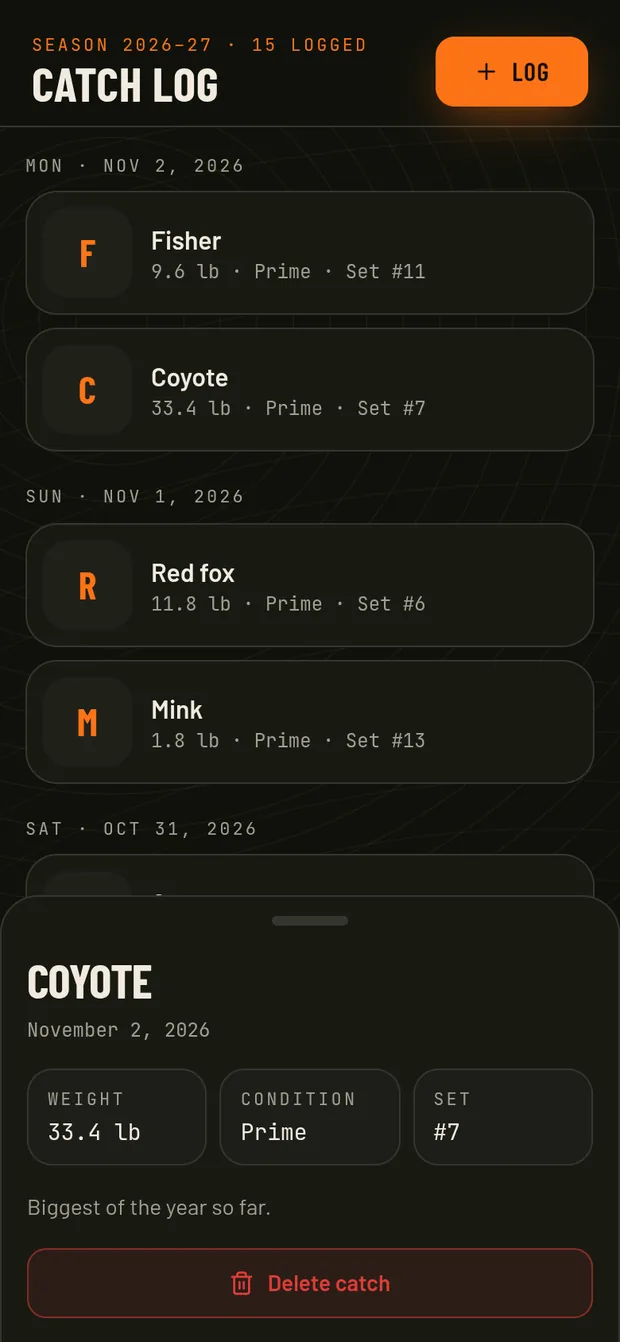
Log catches
Species, weight, condition and the set it came from. Totals add up by season.
- Season dates you set (defaults to July 1 – June 30)
- Totals and weights by species, in lb or kg
- Pelt condition counts
- 05
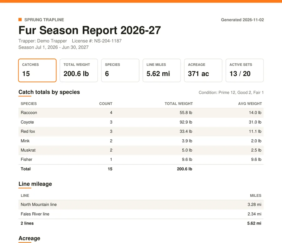
Season reportPro
Download a PDF with catch totals, line miles / km, acres / hectares and your full fur log.
- PDF report for the buyer or your records (Pro)
- CSV export for spreadsheets (free)
- Made right on your phone
- 06
Photo species IDPro
Snap the catch and get a suggested species and a draft log entry to check over.
- Suggests the likely animal and how sure it is
- Fills in species, condition and a note
- Nothing saves until you say so
Suggestion only. You're responsible for confirming species before logging or selling.
- 07
Draw lines
Trace your run between sets and see the line miles / km add up as you go.
- Draw right on the map with your finger
- Miles or km measured for every line
- Several lines per season
- 08
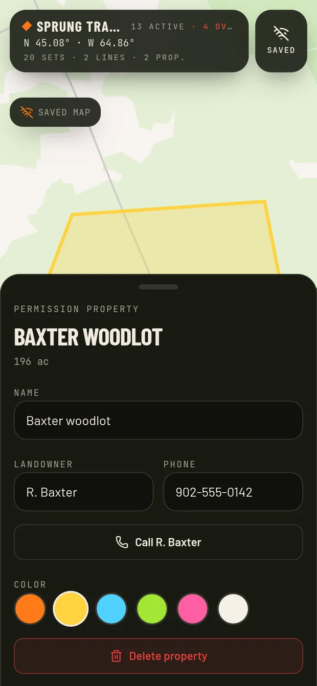
Mark properties
Outline the ground you have permission on, with acres / hectares worked out for you.
- Draw property boundaries
- Acres or hectares shown for each parcel
- Stay on the ground you're allowed on
- 09
Wind & weatherPro
Live wind direction and conditions on the map before you head out.
- Wind arrow right on the map
- Temperature and conditions
- Plan your check order around the wind
- 10
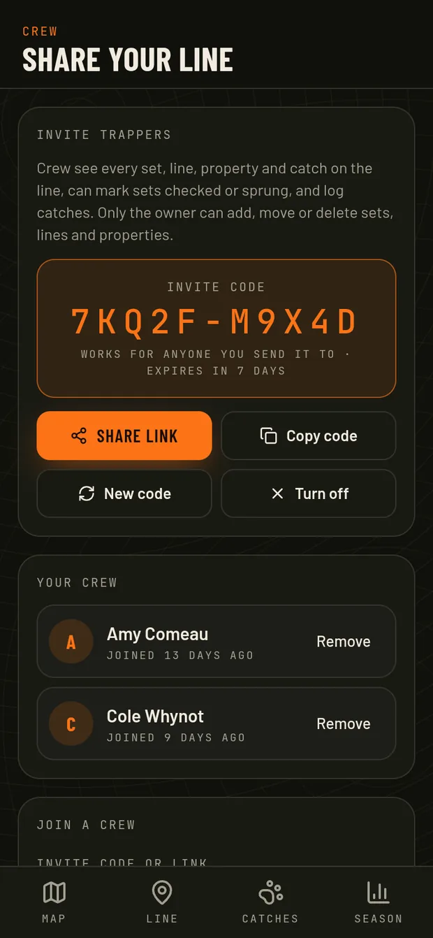
Crew sharingCrew
Invite partners to your line. They check sets and log catches on their own accounts.
- Invite by link or code
- Crew can't move or delete your sets
- Combined crew totals for the season
Ready to map your line?
Free account. Works on any phone or computer.